We have been crossing the Great Dividing Range east to west and west to east for the last four days. Today we would pass through country with rivers running to the Gulf of Carpentaria before travelling through impressive ranges to reach the Coral Sea at Cooktown. This range is the third longest land based range in the world and many of Australia’s greatest landscapes are found along its length.

The Mareeba Wetlands is a wildlife sanctuary just north of Mareeba run by a not for profit organisation. We met a with a bustard on the drive in through farmland.

A darter drying after a breakfast dip in the lagoon.

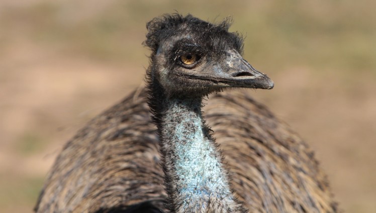
Emus were drinking from the edge of a swamp.

The emus foraged on the savannah grass at the edge of the swamp.

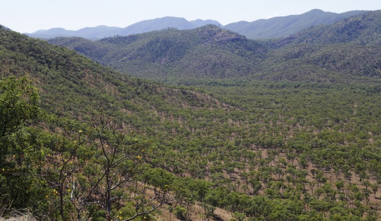
The drive north passes through the very small towns of Mount Molloy and Mount Carbine. Mount Carbine was a mining town that is now a welcome stop for travellers. The pies are noteworthy – the visitor’s book was full of accolades so put it on your itinerary for your next road trip. Nice people too. The road then passes through savannah before climbing to Bob’s Lookout with views back to the wet tropics ranges.
Looking north-east towards the Windsor Tablelands at the back of the Daintree.

Yellow flowered kapok trees dotted the range near the lookout.
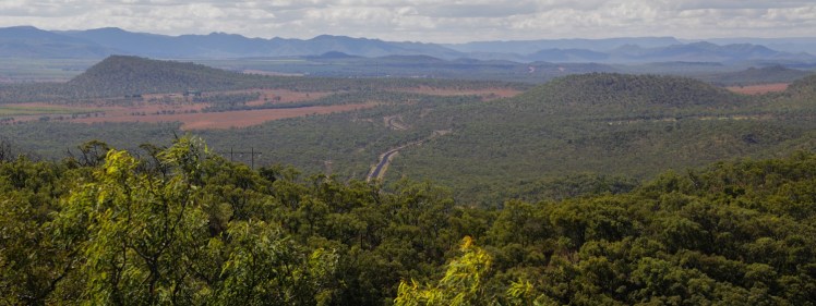
After passing the Palmer River that flows downstream past the old gold-mining ghost town of Maytown to the gulf, we climb the great divide at Byerstown Range with views north into the Laura and Normanby River valleys that run into the Coral Sea at Princess Charlotte Sound.

Spectacular wattles dotted the hillsides.
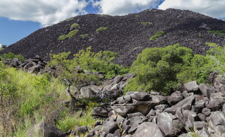
The Mulligan Highway passes Kalkajaka (Black Mountain) – a jumble of granite boulders that was geologically thrust up from underground. The dark colour of the grey granite boulders is blackened by a film of microscopic blue-green algae growing on the exposed surfaces. There are mysteries about disappearances of people in the endless jumble of huge boulders over the years.
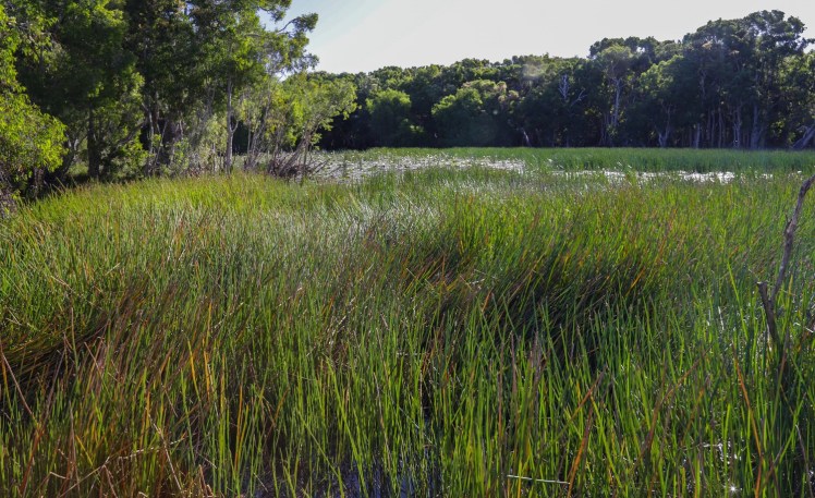
Keating’s Lagoon is a national park swamp with fencing around the carpark and the usual crocodile warning signs. A tranquil lagoon with water lilies is disconcertingly peaceful with its lurking reptiles.

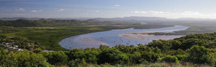
Arriving in Cooktown, we made our way up the steep winding drive for views over town, Mount Cook, the Endeavour River and the ocean.
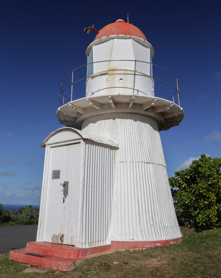
The old lighthouse on Grassy Hill. This is at the point where James Cook looked to sea for a channel through the reefs in 1770.

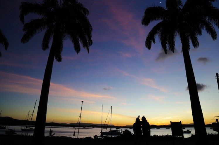
Sunset over the Endeavour River.
Meeting up with a family member in Cooktown – so far a 3991km road trip to see her. It was great to catch up with a work colleague going for dinner at a local hotel; after greeting another work colleague as soon as we arrived in Townsville makes it seem like a small world despite the great distances travelled.
