
Cape Range National Park – today we visited the scenic high country and gorges of the park.

Is this the dirtiest bird in WA?

Outside our accommodation, a Western bowerbird Chlamydera guttata appears on a fence. We had seen some in gorges of Central Australia but they are a disjunct population to the ones in the Pilbara. This one is subspecies cateri which only occurs on North West Cape and is a bit smaller than the other subspecies of the Centre.

The distinctive pink crest on the nape.
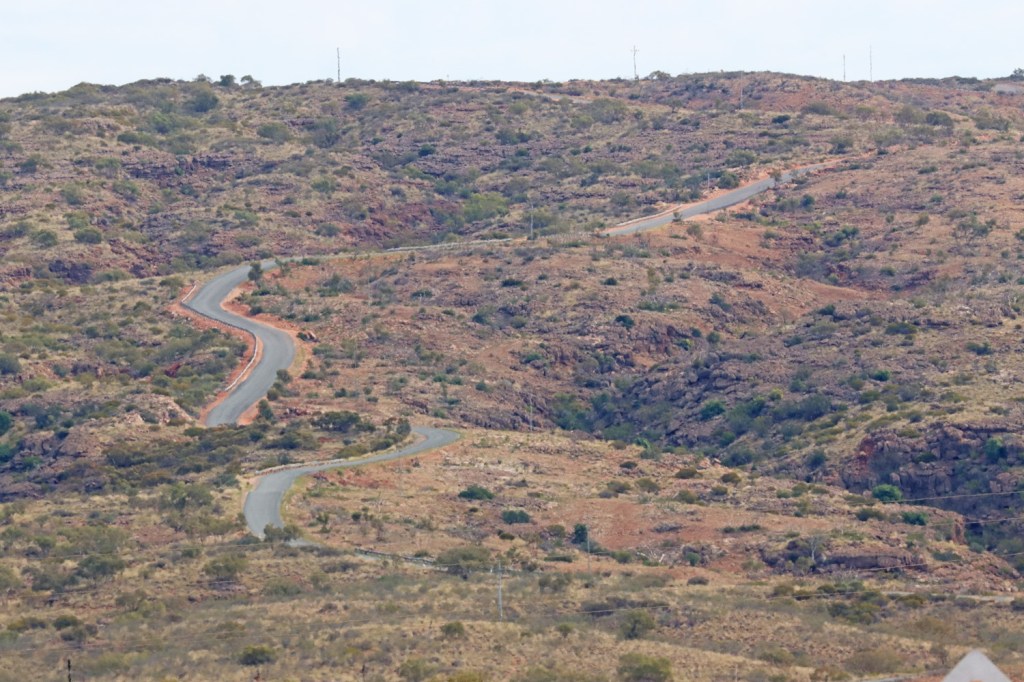
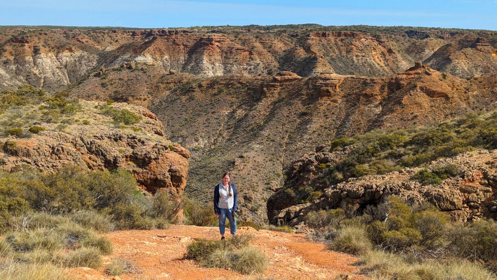
South of Exmouth, a road leads to the top of the range with lookouts across the arid plateau. Charles Knife Canyon Road follows the trail blazed by Charles Knife and Jack King over the Cape Range. Charles Knife surveyed the road across the range to enable access for the drilling teams of West Australian Petroleum Pty Ltd (WAPET) who were in search of oil.
Canyon view as the road ascends the range. The road was recently maintained. There is bitumen on the steep ascent and good gravel across the top of the range and stopping points at multiple lookouts.

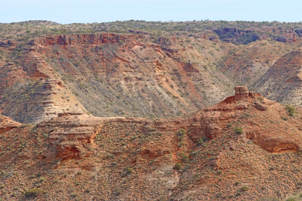
The range is limestone with its distinctive tropical karst weathering.

Many caves are visible from the road but inaccessible due to the precipitous terrain. This cave looks a bit ominous.
A Cape Range Kurrajong (Brachychiton obtusifolus) endemic to the Cape Range

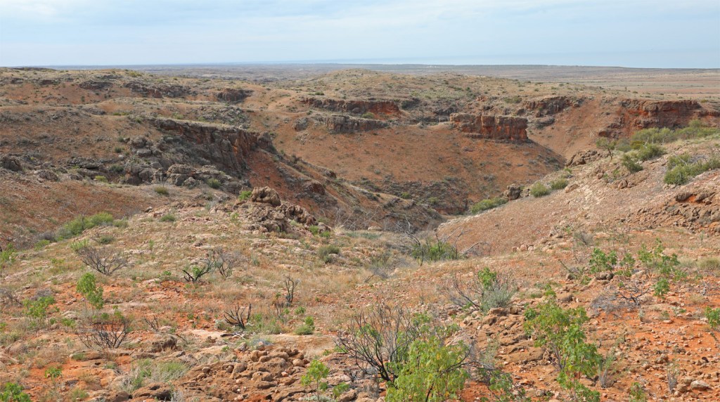
The view into the canyon was absolutely gorges.

Charles Knife Canyon Road has views to Exmouth Gulf
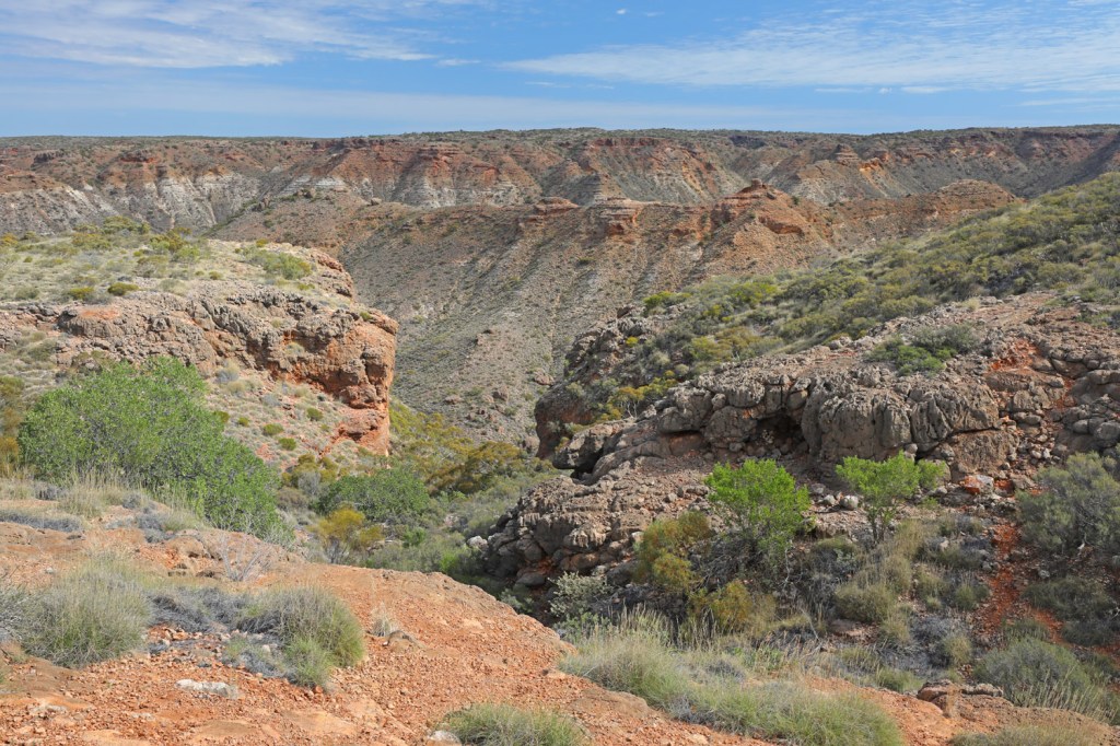
The range gets deeper the further we travel.


The road along a razorback ridge with canyons on both sides.

Charles Knife Canyon

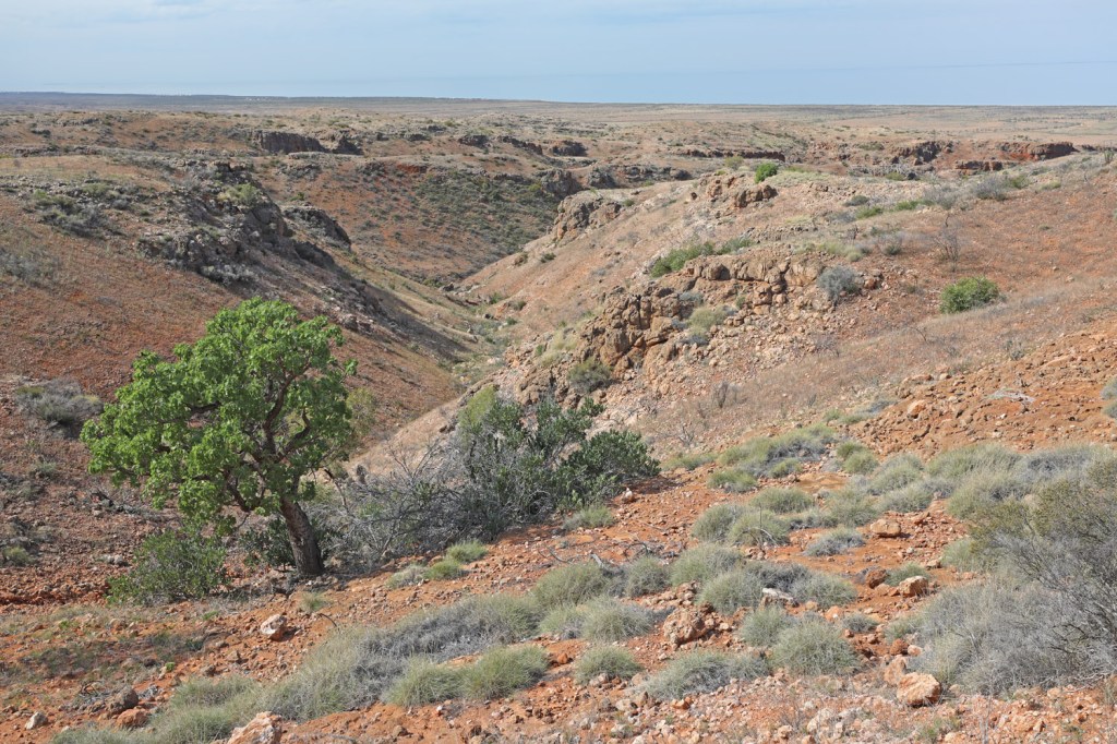
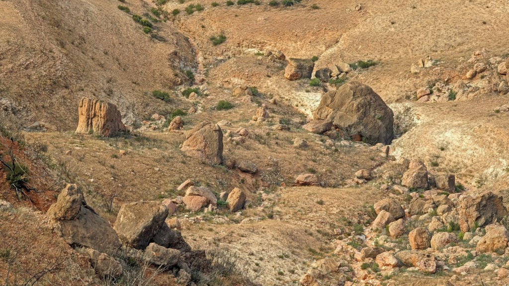
The dry riverbed below
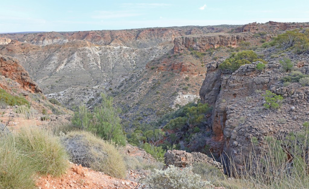
Canyon on the south side of the road
The limestone is very unstable around the cliff edges. Large cracks are across the ground in places.
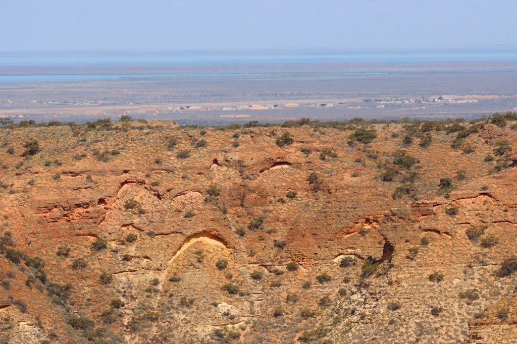
The man in the mountain was not happy. View over a ridge to the Learmonth RAAF base.
Shothole Canyon is another gorge in the Cape Range but we were advised not to tackle this one due to the current state of the road.

Pebble Beach – why did the pebble cross the beach? So it could be a bit boulder.
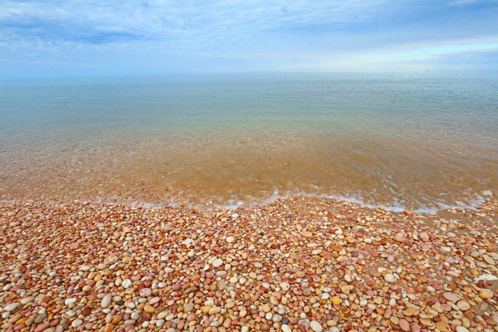
The wash made clinking sounds.

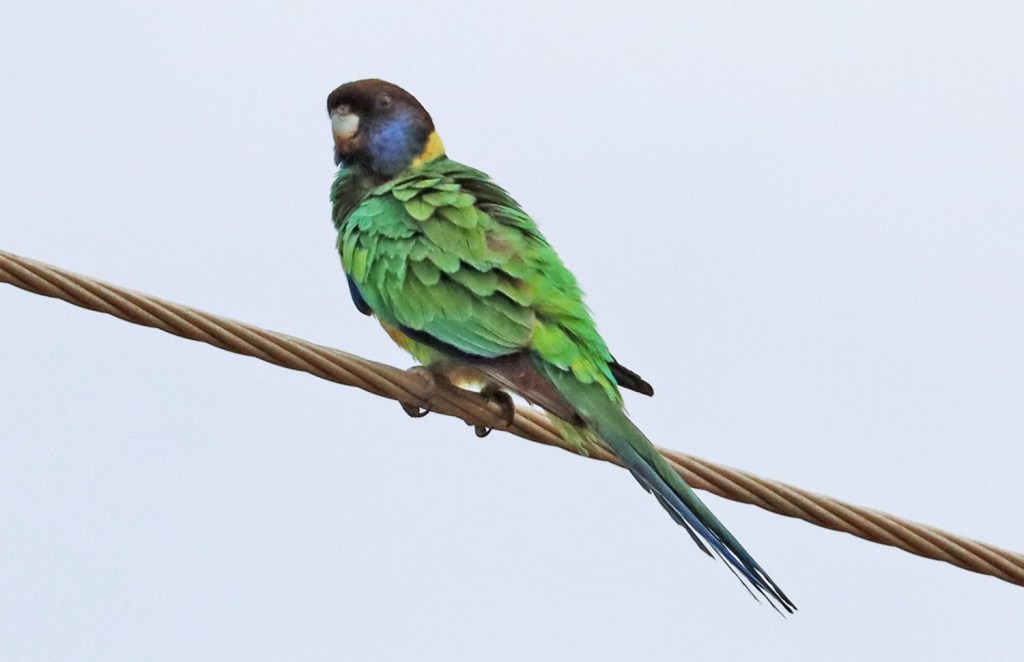
A ringneck feeling a bit ruffled late in the day.
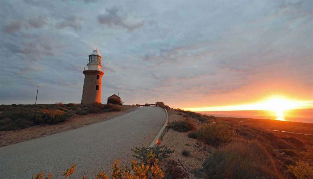
Late in the day we drove north of town to Vlamingh Head Lighthouse. The lighthouse is 61m above sea level and completed in 1912. The wreck of the SS Mildura on the reef nearby demonstrated the need for a lighthouse near the end of the cape.
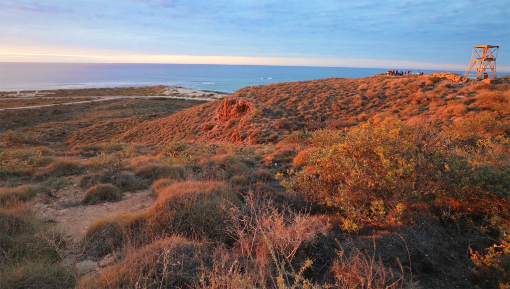
The ruins of a WWII radar tower near the lighthouse


Naval Communication Station Harold E. Holt is a joint Australian and United States naval communication station operated and maintained by Australian Defence Force on behalf of Australia and the United States. It provides very low frequency (VLF) radio transmission to United States Navy, Royal Australian Navy and allied ships and submarines in the western Pacific Ocean and eastern Indian Ocean. It is the most powerful transmission station in the Southern Hemisphere.


The anchor from the Mildura wreck. It was weigh more than we expected.

Vlamingh Head was named after Dutch explorer Willem de Vlamingh who sailed here on an expedition in 1697.

And in all the peace and tranquility of the sunset, someone has to put up a drone…. having a drone buzzing above you while trying to enjoy a sunset isn’t the most annoying thing that has happened to me but is certainly up there.
