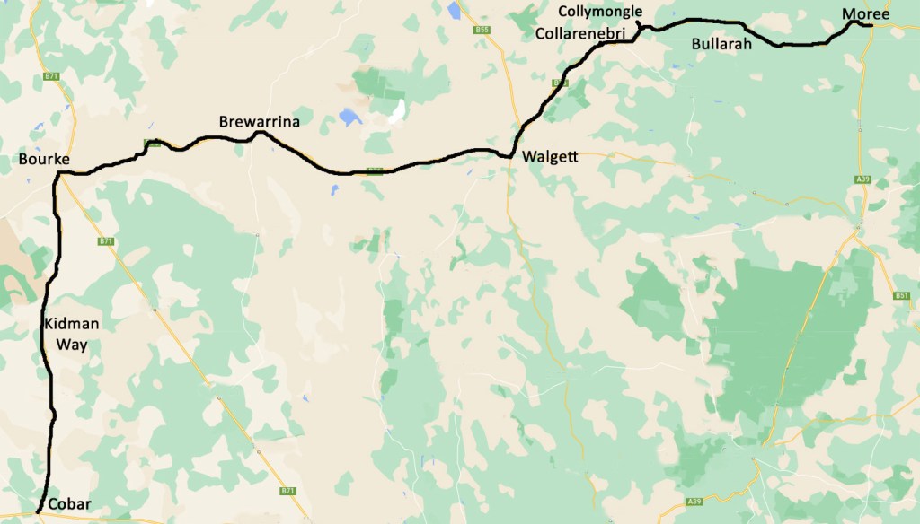
We spend a large part of today on the Barwon River floodplain. The Barwon is 700km long and starts as the MacIntyre River on the Queensland/NSW border near Mungindi and becomes the Darling River near Bourke at the confluence of the Culgoa/Balonne/Condamine River system. We cross the Barwon River four times as we journey west.
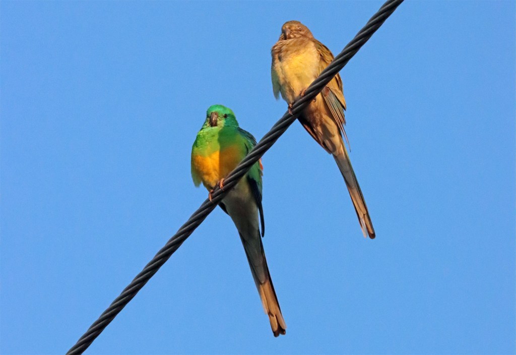
A cold start to the day in Moree – the Red rumped parrots took a while to warm up too.

We passed lots of trucks carrying cotton along the Gwydir Highway

Cows on roadside adjistment near Bullarah
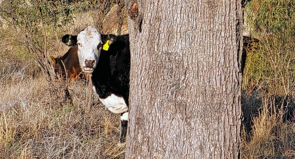
Peek-a-moo

Black shouldered kite warming up after a big night out
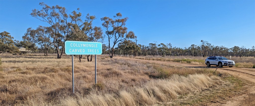
Just east of Collarenebri off the Gwydir Highway is the Collymongle Carved Trees site. Carved trees or Dendroglyphs were common at bora rings and gravesites. Collymongle originally had at least 82 carved trees around the two bora rings. Many were removed to museums or taken by collectors. The shelter provides protection for some of the incredibly significant carved trees of the Kamilaroi First Nations Peoples.


Map showing sites in northern NSW from The dendroglyphs or “carved trees” of New South Wales by R. Etheridge (1918). Online from State Library of NSW. This site is marked 71 in the left centre of the map.
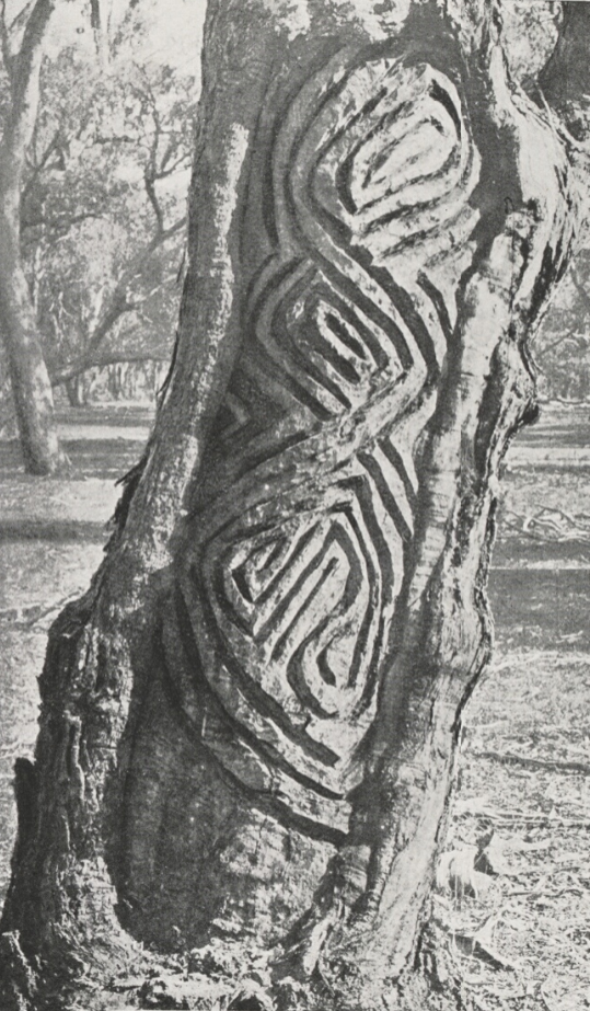
Image of a Collymongle dendroglyph from The dendroglyphs or “carved trees” of New South Wales by R. Etheridge (1918). Online from State Library of NSW. In 1949, a wealthy Adelaide collector and businessman supervised a team of timber workers and felled dozens of carved trees. The trees – some possibly as old as 800 years – were covered in detailed carvings and sacred to the Kamilaroi First Nations people. Using circular saws to separate the large carved sections from the trunks, they were loaded on to trucks, transported by rail and stacked on to ships for sale and distribution around the globe. The local community in Collarenebri is searching globally for the return of the trees.

The historic Barwon Bridge at Brewarrina was built in 1888. It is a lift span bridge that allowed paddle steamers and barges loaded high with wool bales to pass. It is one of four lift span bridges built on the Darling-Barwon, others are at Bourke, Wilcannia and Wentworth. There were a few issues here once but now its just water under the bridge.

Historical image from visitnsw.com
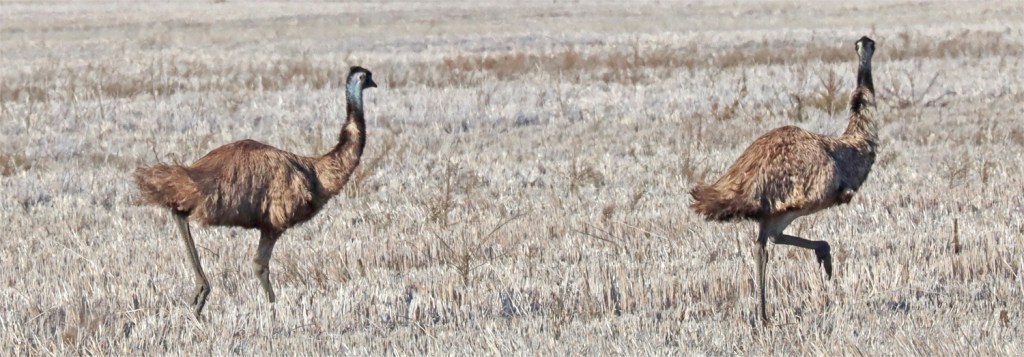
We saw our first emus of the day between Collarenebri and Walgett. These ran away at first, then became inquisitive and came for a closer look.
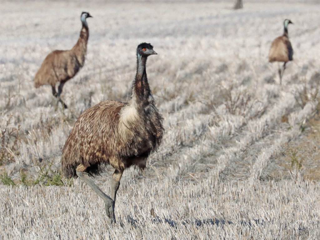
Emu Count today: 72

Large flocks of Apostle birds were common

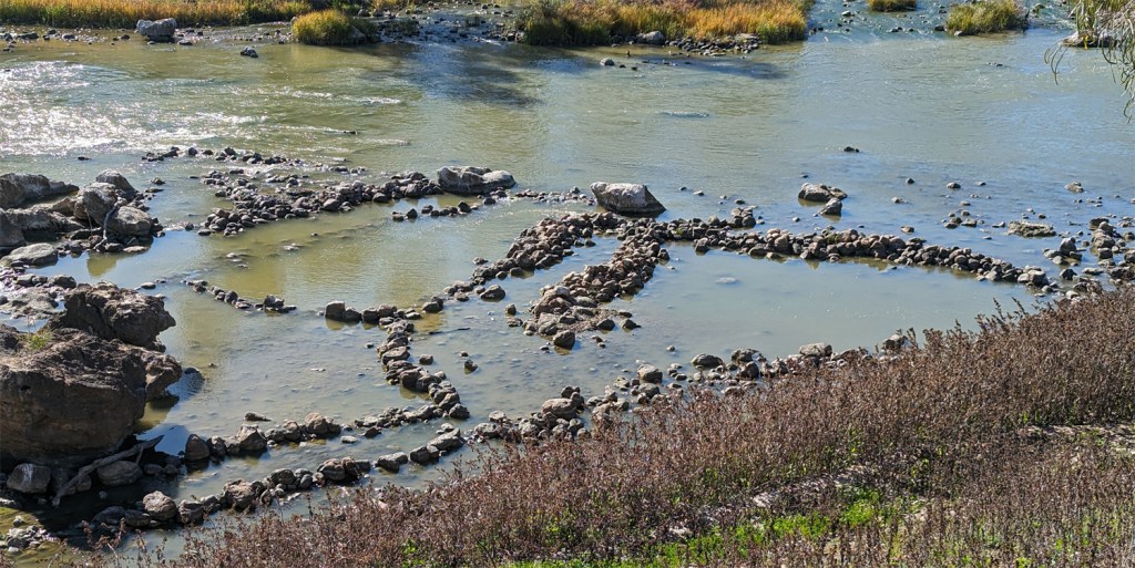
The Brewarrina Fish Traps – a complex network of river stones arranged to catch fish by the Ngemba people to form ponds and channels are one of the oldest known human-made structures in the world. Some friendly locals showed us the best location to view the traps. Highly recommended if you are in this part of the world.

Another roadside stop for wildflower investigation.

Daisies emerging following good rains a few weeks ago.

The Kidman Way – the open plains made way for mulga scrub. After the horrors of the potholed Newell Highway yesterday afternoon, the 160km from Bourke to Cobar is a great drive.

This is also the domain of the goat – there were lots of kids on Kidman Way
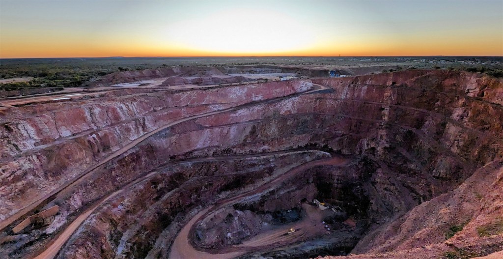
Cobar Gold Mine from Fort Bourke Hill looking west.
